
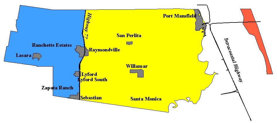
View Map
List of Communities
Description of Dividing Line
View a complete list of all Appointed Engineers and the types of inspections that they perform on the windstorm system.

This product is for informational purposes and is not prepared for or suitable for legal, engineering, or surveying purposes. It does not represent an on-the-ground survey and represents only the approximate relative location of property boundaries.
The Texas Department of Insurance produces maps for general informational use only. No warranty is made by TDI regarding specific accuracy or completeness. It is the user's responsibility to verify all data represented in the maps.
Note: All structures located inside the city limits of a city or town which is divided by the dividing line between inland I and inland II shall be subject to the Inland II requirements.
List of Communities
The following is a list of communities located in Willacy County. The communities have been categorized according to the zone they fall under. If a structure is located in a community or area not shown below, then refer to the county map to determine which zone the structure falls under.
INLAND II- 2006 IBC/IRC with the Texas Revisions, 110 mph 3-second gust design wind speed
Lasara
Lyford
Raymondville
Sebastian
Yturria
INLAND I- 2006 IBC/IRC with the Texas Revisions, 120 mph 3-second gust design wind speed
Los Coyotes
Paso Real
Porfirio
Port Mansfield
San Perlita
Santa Margarita
Santa Monica
Willamar
SEAWARD- 2006 IBC/IRC with the Texas Revisions, 130 mph 3-second gust design wind speed
Padre Island National Seashore
Written Description of Dividing Line:
Cameron, Willacy, Kenedy, and Kleberg Counties: Moving south to north in Cameron County beginning at the intersection of the international border of Mexico and the United States following the western city limits of the City of Brownsville, Texas, north to the intersection of the western city limits of the City of Brownsville, Texas, with U.S. Highway 77; continuing along U.S. Highway 77 through the counties of Cameron, Willacy, Kenedy, and Kleberg.